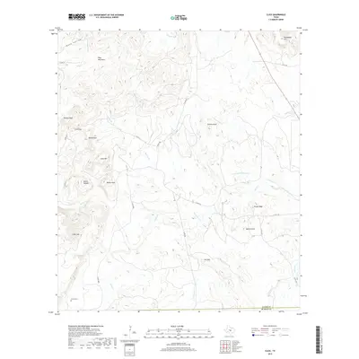
2019 Map of Click
USGS Topo · Published 2019About this map
The Riley Mountains dominate this Central Texas landscape, creating a topography of significant elevation changes and deep drainages. In this rural portion of Llano County, early land use and settlement patterns are visible through family landmarks and established routes like Co RD 312. Notable peaks such as Packsaddle Mtn, Watson Mtn, and Lucky Mtn frame the corridor leading to the Click Gap pass. The local genealogy and communal history are anchored by the Martin Cem in the southwest, while the drainage network of Sandy Creek, Comanche Cr, and Cottonwood Cr defines the lowlands. The survey reveals a region of granite outcrops and quartz formations, evidenced by features like Granite Knob, Red Mtn, and Quartz Knob. This detailed map documents the intersection of Llano and Blanco counties along a line defined by natural ridges and watercourses.
Find a feature on this map
35 named features on this map. Tap any name to fly to it.
Don’t see what you’re looking for? This feature index may not catch every label — zoom into the map to look around manually.
Map Details
Editions of this 2019 Click Map
This is the sole edition of this map. No revisions or reprints were ever made.
Other maps of this area

1887 · Llano
USGS Topo · 1:125,000

1887 · Blanco
USGS Topo · 1:125,000

1887 · Burnet
USGS Topo · 1:125,000

1893 · Burnet
USGS Topo · 1:125,000

1894 · Fredericksburg
USGS Topo · 1:125,000

1894 · Blanco
USGS Topo · 1:125,000

1894 · Llano
USGS Topo · 1:125,000

1903 · Burnet
USGS Topo · 1:125,000

1904 · Llano
USGS Topo · 1:125,000

1909 · Llano
USGS Topo · 1:125,000