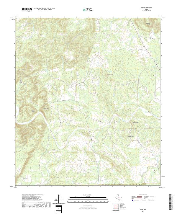
2022 Map of Click
USGS Topo · Published 2022About this map
The Riley Mountains dominate this central Texas landscape, characterized by numerous peaks and unique geological markers. The terrain is punctuated by significant rises such as Walker Peak, Packsaddle Mtn, and the curiously named Devils Toenail. A network of creeks and branches, including Sandy Creek and its various tributaries like S Prong Cottonwood Cr, drains the uplands. Near the southwest corner, the Martin Cem serves as a primary point of interest for genealogists and local historians, situated near the headwaters of Coal Cr. The passage through Click Gap and the presence of Granite Knob and Quartz Knob suggest the mineral complexity of the Llano Uplift. The map also delineates the border between Llano County and Blanco County, capturing the rural road network connecting remote family-named landmarks like Watson Mtn and Hickory Bluff.
Find a feature on this map
35 named features on this map. Tap any name to fly to it.
Don’t see what you’re looking for? This feature index may not catch every label — zoom into the map to look around manually.
Map Details
Editions of this 2022 Click Map
This is the sole edition of this map. No revisions or reprints were ever made.
Other maps of this area

1887 · Llano
USGS Topo · 1:125,000

1887 · Blanco
USGS Topo · 1:125,000

1887 · Burnet
USGS Topo · 1:125,000

1893 · Burnet
USGS Topo · 1:125,000

1894 · Fredericksburg
USGS Topo · 1:125,000

1894 · Blanco
USGS Topo · 1:125,000

1894 · Llano
USGS Topo · 1:125,000

1903 · Burnet
USGS Topo · 1:125,000

1904 · Llano
USGS Topo · 1:125,000

1909 · Llano
USGS Topo · 1:125,000