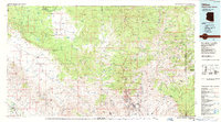
1986 Map of Clifton
USGS Topo · Published 1987About this map
Industrial scale meets high desert topography where the massive Morenci Open Pit dominates the landscape near the town of Clifton. This mid-1980s data highlights the sprawling mining complex and its associated infrastructure, including a substantial Tailings Pond and the nearby settlement of Stargo. The surrounding terrain transitions from the high Nantac Rim and Nananes Plateau to the river valleys that have shaped human activity in the region for centuries.
Find a feature on this map
33 named features on this map. Tap any name to fly to it.
Don’t see what you’re looking for? This feature index may not catch every label — zoom into the map to look around manually.
Map Details
Editions of this 1986 Clifton Map
2 editions found
Other maps of this area

1902 · Clifton
USGS Topo · 1:62,500

1910 · Mogollon
USGS Topo · 1:125,000

1912 · Mogollon
USGS Topo · 1:125,000

1913 · Morenci
USGS Topo · 1:125,000

1915 · Morenci
USGS Topo · 1:125,000

1915 · Reserve
USGS Topo · 1:125,000

1918 · Reserve
USGS Topo · 1:125,000

1922 · Nutrioso
USGS Topo · 1:125,000

1944 · Jackson Mtn.
USGS Topo · 1:62,500

1946 · Jackson Mtn.
USGS Topo · 1:62,500