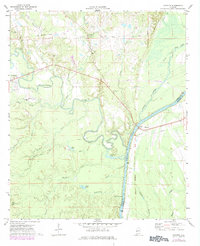
1971 Map of Coatopa
USGS Topo · Published 1984About this map
Coatopa and Bellamy define the settlement pattern of this West Alabama landscape, situated just west of the winding Tombigbee River. The terrain is deeply influenced by the waterways that converge here, including the Sucarnoochee River and Spring Creek. Evidence of former transportation networks is visible in the Old Railroad Grade and Railroad Grade sections near Pankabia Creek, showing the transition from rail dependence to the highway system.
Find a feature on this map
37 named features on this map. Tap any name to fly to it.
Don’t see what you’re looking for? This feature index may not catch every label — zoom into the map to look around manually.
Map Details
Editions of this 1971 Coatopa Map
4 editions found

Other maps of this area

1929 · Epes
USGS Topo · 1:48,000

1932 · Epes
USGS Topo · 1:62,500

1948 · Mc Dowell
USGS Topo · 1:24,000

1949 · Mc Dowell
USGS Topo · 1:24,000

1953 · Montgomery
USGS Topo · 1:250,000

1953 · Meridian
USGS Topo · 1:250,000

1956 · Montgomery
USGS Topo · 1:250,000

1957 · Meridian
USGS Topo · 1:250,000

1957 · Montgomery
USGS Topo · 1:250,000

1965 · Meridian
USGS Topo · 1:250,000