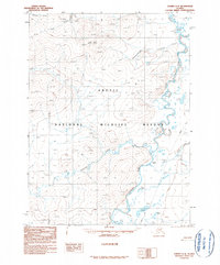
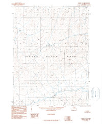
1990 Map of Coleen C-4
USGS Topo · Published 1990About this map
The Coleen River meanders through the heart of the Arctic National Wildlife Refuge in this late twentieth-century landscape. Characterized by intricate drainage networks, the map captures the junction where Boulder Creek feeds into the main river channel. Evidence of human presence is sparse but specific, marked by the solitary location of Owens Cabins on the eastern bank.
Find a feature on this map
11 named features on this map. Tap any name to fly to it.
Don’t see what you’re looking for? This feature index may not catch every label — zoom into the map to look around manually.
Map Details
Editions of this 1990 Coleen C-4 Map
This is the sole edition of this map. No revisions or reprints were ever made.
Other maps of this area

1951 · Coleen
USGS Topo · 1:250,000

1956 · Coleen
USGS Topo · 1:250,000
1972 · Coleen D-4
USGS Topo · 1:63,360
1972 · Coleen D-5
USGS Topo · 1:63,360
1972 · Coleen D-3
USGS Topo · 1:63,360
1990 · Coleen B-3
USGS Topo · 1:63,360
1990 · Coleen B-5
USGS Topo · 1:63,360
1990 · Coleen C-3
USGS Topo · 1:63,360
1990 · Coleen B-4
USGS Topo · 1:63,360
1990 · Coleen C-5
USGS Topo · 1:63,360