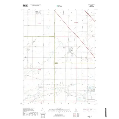
2019 Map of Colfax
USGS Topo · Published 2019About this map
Clarks Hill and Colfax serve as primary anchors for this region where four Indiana counties—Tippecanoe, Montgomery, Clinton, and Boone—converge. The landscape is defined by the winding course of Sugar Creek and its many tributaries, including Goldsberry Creek and Little Potato Cr. For local historians and genealogists, the map is particularly rich in cemetery locations, documenting smaller family or community burial grounds such as Loveless Cem, Shiloh Cem, and Clouser Cem. The settlement of Bowers marks a quiet crossroads in the southern portion of the survey, connected by a network of county roads that follow the rigid section lines of the Public Land Survey System. These roads, such as Co Line Rd 1200 N, underscore the agricultural geometry that has shaped this portion of the Indiana heartland.
Find a feature on this map
74 named features on this map. Tap any name to fly to it.
Don’t see what you’re looking for? This feature index may not catch every label — zoom into the map to look around manually.
Map Details
Editions of this 2019 Colfax Map
This is the sole edition of this map. No revisions or reprints were ever made.
Other maps of this area

1953 · Danville
USGS Topo · 1:250,000

1955 · Danville
USGS Topo · 1:250,000

1956 · Danville
USGS Topo · 1:250,000

1958 · Darlington
USGS Topo · 1:24,000

1958 · Kirkpatrick
USGS Topo · 1:24,000

1961 · Mulberry
USGS Topo · 1:24,000

1961 · Stockwell
USGS Topo · 1:24,000

1961 · Frankfort
USGS Topo · 1:24,000
1961 · Hazelrigg
USGS Topo · 1:24,000
1961 · Shannondale
USGS Topo · 1:24,000