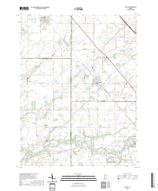
2022 Map of Colfax
USGS Topo · Published 2022About this map
Colfax sits at the convergence of several county lines in this rural Indiana landscape, where the borders of Clinton, Montgomery, Boone, and Tippecanoe Counties meet. The town's grid is oriented alongside the Big Four Trl, reflecting the historical impact of the railroad on local development. To the northwest, Clarks Hill marks another established node of settlement, while the smaller community of Bowers lies to the southwest along the banks of Little Potato Cr. The area is characterized by its numerous family and community burial grounds, including Shiloh Cem and McKendree Cem, which serve as vital landmarks for local genealogical research. Drainage patterns across the agricultural plains are defined by the winding paths of Sugar Creek and Goldsberry Creek, which eventually feed into the larger regional watersheds. This topography highlights the transition from traditional rail-oriented towns to the modern county road system that now defines movement through these four counties.
Find a feature on this map
48 named features on this map. Tap any name to fly to it.
Don’t see what you’re looking for? This feature index may not catch every label — zoom into the map to look around manually.
Map Details
Editions of this 2022 Colfax Map
This is the sole edition of this map. No revisions or reprints were ever made.
Other maps of this area

1953 · Danville
USGS Topo · 1:250,000

1955 · Danville
USGS Topo · 1:250,000

1956 · Danville
USGS Topo · 1:250,000

1958 · Darlington
USGS Topo · 1:24,000

1958 · Kirkpatrick
USGS Topo · 1:24,000

1961 · Mulberry
USGS Topo · 1:24,000

1961 · Stockwell
USGS Topo · 1:24,000

1961 · Frankfort
USGS Topo · 1:24,000
1961 · Hazelrigg
USGS Topo · 1:24,000
1961 · Shannondale
USGS Topo · 1:24,000