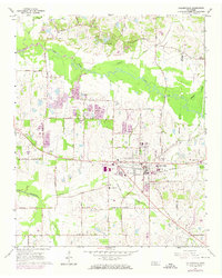
1965 Map of Collierville
USGS Topo · Published 1974About this map
The town of Collierville serves as the focal point of this Shelby County landscape, where the Southern railroad provides a straight east-west axis through the heart of the community. In the mid-1960s, the area reflects a transition between established agricultural land and early suburban expansion, evidenced by the dense grid of residential streets near Collierville School and St James Church. Outside the central district, the terrain is defined by the winding Wolf River to the north and Nonconnah Creek to the south, with rural life centered around local landmarks such as Magnolia Cemetery and Abington Cemetery. Smaller settlements like Piperton and Bailey anchor the outskirts, connected by a network of historic routes including Raleigh La Grange Road and Houston Levee Road. The map also captures the local industrial footprint through several Gravel Pits and the Sewage Disposal facility near the town center.
Find a feature on this map
56 named features on this map. Tap any name to fly to it.
Don’t see what you’re looking for? This feature index may not catch every label — zoom into the map to look around manually.
Map Details
Editions of this 1965 Collierville Map
4 editions found
Other maps of this area

1943 · Collierville
USGS Topo · 1:62,500

1944 · Hernando
USGS Topo · 1:62,500

1948 · Byhalia
USGS Topo · 1:62,500

1953 · Collierville
USGS Topo · 1:50,000

1956 · Blytheville
USGS Topo · 1:250,000

1956 · Tupelo
USGS Topo · 1:250,000

1958 · Tupelo
USGS Topo · 1:250,000

1959 · Blytheville
USGS Topo · 1:250,000

1960 · Bartlett
USGS Topo · 1:62,500

1961 · Bartlett
USGS Topo · 1:62,500