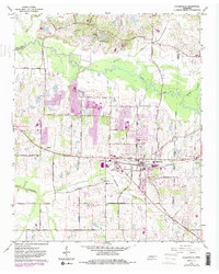
1965 Map of Collierville
USGS Topo · Published 1984About this map
Collierville stands as the central hub of this eastern Shelby County landscape, positioned along the Southern railroad line as it heads toward the Shelby Co Fayette Co boundary. In the mid-1960s, the area retained a distinctly agrarian and small-town character, before the massive suburban expansion of later decades reached this far east. Along the Wolf River, a series of Gravel Pits and a prominent Houston Levee indicate the industrial and flood-control efforts of the era, while the rural roads are dotted with family and community landmarks like St Marks Cem and Magnolia Cem.
Find a feature on this map
46 named features on this map. Tap any name to fly to it.
Don’t see what you’re looking for? This feature index may not catch every label — zoom into the map to look around manually.
Map Details
Editions of this 1965 Collierville Map
4 editions found
Other maps of this area

1943 · Collierville
USGS Topo · 1:62,500

1944 · Hernando
USGS Topo · 1:62,500

1948 · Byhalia
USGS Topo · 1:62,500

1953 · Collierville
USGS Topo · 1:50,000

1956 · Blytheville
USGS Topo · 1:250,000

1956 · Tupelo
USGS Topo · 1:250,000

1958 · Tupelo
USGS Topo · 1:250,000

1959 · Blytheville
USGS Topo · 1:250,000

1960 · Bartlett
USGS Topo · 1:62,500

1961 · Bartlett
USGS Topo · 1:62,500