
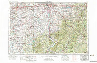
1967 Map of Columbus
USGS Topo · Published 1969About this map
Columbus and its expanding suburbs of Bexley, Whitehall, and Upper Arlington anchor the northern reaches of this regional survey, which illustrates the transition from urban centers to the heavily forested landscapes of Southern Ohio. The map captures a significant concentration of higher education and institutional landmarks, from Ohio State University in the capital to Wilberforce University near Xenia and Ohio University in Athens. Central Ohio's mid-century water management is evident in the inclusion of Buckeye Lake, Paint Creek Reservoir, and Rocky Fork Lake.
Find a feature on this map
99 named features on this map. Tap any name to fly to it.
Don’t see what you’re looking for? This feature index may not catch every label — zoom into the map to look around manually.
Map Details
Editions of this 1967 Columbus Map
2 editions found
Other maps of this area

1901 · Dublin
USGS Topo · 1:62,500

1902 · Westerville
USGS Topo · 1:62,500

1903 · Dublin
USGS Topo · 1:62,500

1903 · Athens
USGS Topo · 1:62,500

1904 · Westerville
USGS Topo · 1:62,500

1904 · Springfield
USGS Topo · 1:62,500

1904 · Zaleski
USGS Topo · 1:62,500

1904 · Dayton
USGS Topo · 1:62,500

1904 · Chesterhill
USGS Topo · 1:62,500

1905 · Athens
USGS Topo · 1:62,500