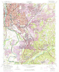
1955 Map of Columbus
USGS Topo · Published 1975About this map
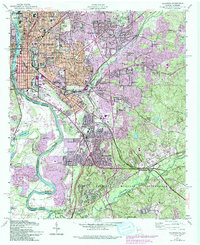
The Chattahoochee River defines the western edge of this mid-century urban landscape, serving as both a state boundary and an industrial corridor. The city's growth is evident in the transition from established neighborhoods like Rose Hill and East Highlands to newer residential developments such as Parkchester and Woodlawn Estates. Industrial activity is concentrated near the river, marked by a Hydro Plant and several clay pits, while the southern portion of the map is dominated by the sprawling Fort Benning Military Reservation.
Find a feature on this map
125 named features on this map. Tap any name to fly to it.
Don’t see what you’re looking for? This feature index may not catch every label — zoom into the map to look around manually.
Map Details
Editions of this 1955 Columbus Map
5 editions found
Other maps of this area

1907 · Talbotton
USGS Topo · 1:125,000

1907 · Opelika
USGS Topo · 1:125,000

1908 · Columbus
USGS Topo · 1:62,500

1909 · Opelika
USGS Topo · 1:125,000

1914 · Seale
USGS Topo · 1:62,500

1929 · Columbus
USGS Topo · 1:48,000

1947 · Columbus
USGS Topo · 1:62,500

1949 · Midland
USGS Topo · 1:24,000

1949 · Fort Mitchell
USGS Topo · 1:24,000

1949 · Ochillee
USGS Topo · 1:24,000