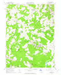
1961 Map of Colver
USGS Topo · Published 1963About this map
The industrial and community layout of the Pennsylvania coal fields is evident in this landscape on the border of Indiana and Cambria counties. Centered on the company town of Colver, the map details the infrastructure of extraction, from the extensive rail network of the Pennsylvania railroad to the numerous mine dumps, tipples, and shafts like Portal No 1. The settlement pattern reflects the era's labor housing, specifically noted in residential pockets like Nine Row and Twenty-Row, while civic life is anchored by institutions such as St Nicholas Sch, Kingdom Hall Ch, and Mt Union Ch.
Find a feature on this map
73 named features on this map. Tap any name to fly to it.
Don’t see what you’re looking for? This feature index may not catch every label — zoom into the map to look around manually.
Map Details
Editions of this 1961 Colver Map
4 editions found
Other maps of this area

1902 · Ebensburg
USGS Topo · 1:62,500

1902 · Patton
USGS Topo · 1:62,500

1902 · Barnesboro
USGS Topo · 1:62,500

1904 · Barnesboro
USGS Topo · 1:62,500

1904 · Patton
USGS Topo · 1:62,500

1904 · Ebensburg
USGS Topo · 1:62,500

1904 · Johnstown
USGS Topo · 1:62,500

1907 · Johnstown
USGS Topo · 1:62,500

1943 · Punxsutawney
USGS Topo · 1:125,000

1953 · Pittsburgh
USGS Topo · 1:250,000
Featured Places
- East Carroll Township, PA
- Cambria Township, PA
- Bakersville, Cambria Township
- Colver, Cambria Township
- Belsano Crossing, Blacklick Township