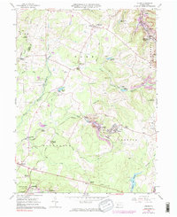
1961 Map of Colver
USGS Topo · Published 1983About this map
The industrial coal landscape of Cambria County is meticulously documented in this 1961 survey, where the company town of Colver serves as a central hub. Distinctive neighborhood designations such as Nine Row and Twenty Row reflect the structured planning of early 20th-century mining communities. The Cambria and Indiana RR weaves through the terrain, connecting various extraction points like Portal No 15 and Portal No 1 to the broader regional economy. Significant extraction features, including a prominent Mine Dump and several Strip Mine sites, are shown alongside civilian landmarks like the St Nicholas Sch and Township High Sch.
Find a feature on this map
70 named features on this map. Tap any name to fly to it.
Don’t see what you’re looking for? This feature index may not catch every label — zoom into the map to look around manually.
Map Details
Editions of this 1961 Colver Map
4 editions found
Other maps of this area

1902 · Ebensburg
USGS Topo · 1:62,500

1902 · Patton
USGS Topo · 1:62,500

1902 · Barnesboro
USGS Topo · 1:62,500

1904 · Barnesboro
USGS Topo · 1:62,500

1904 · Patton
USGS Topo · 1:62,500

1904 · Ebensburg
USGS Topo · 1:62,500

1904 · Johnstown
USGS Topo · 1:62,500

1907 · Johnstown
USGS Topo · 1:62,500

1943 · Punxsutawney
USGS Topo · 1:125,000

1953 · Pittsburgh
USGS Topo · 1:250,000
Featured Places
- East Carroll Township, PA
- Cambria Township, PA
- Bakersville, Cambria Township
- Colver, Cambria Township
- Belsano Crossing, Blacklick Township