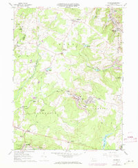
1961 Map of Colver
USGS Topo · Published 1973About this map
Industrial coal mining signatures and rural settlements define this Cambria County landscape during the early 1960s. The company town of Colver serves as a central hub, flanked by the residential blocks of Nine Row and Twenty Row. Extensive mining infrastructure is visible throughout the quadrangle, including a Tipple, several Strip Mine operations near Watkins, and various mine portals such as Portal No 1. The Penn Central railroad network facilitates the movement of resources through Regan Junction, connecting these remote extraction points to broader markets.
Find a feature on this map
73 named features on this map. Tap any name to fly to it.
Don’t see what you’re looking for? This feature index may not catch every label — zoom into the map to look around manually.
Map Details
Editions of this 1961 Colver Map
4 editions found
Other maps of this area

1902 · Ebensburg
USGS Topo · 1:62,500

1902 · Patton
USGS Topo · 1:62,500

1902 · Barnesboro
USGS Topo · 1:62,500

1904 · Barnesboro
USGS Topo · 1:62,500

1904 · Patton
USGS Topo · 1:62,500

1904 · Ebensburg
USGS Topo · 1:62,500

1904 · Johnstown
USGS Topo · 1:62,500

1907 · Johnstown
USGS Topo · 1:62,500

1943 · Punxsutawney
USGS Topo · 1:125,000

1953 · Pittsburgh
USGS Topo · 1:250,000
Featured Places
- East Carroll Township, PA
- Cambria Township, PA
- Bakersville, Cambria Township
- Colver, Cambria Township
- Belsano Crossing, Blacklick Township