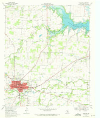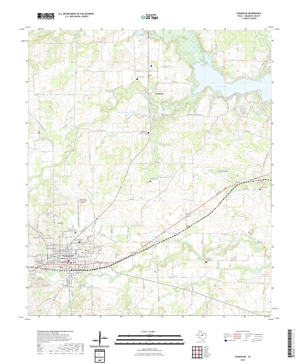
1985 Map of Comanche
USGS Topo · Published 1992About this map
Camp Bowie Military Reservation anchors the southwest corner of this Central Texas landscape, where the Cross Timbers meets the rolling plains. The 1980s terrain is defined by a dense network of seasonal watercourses like Pecan Bayou and Blanket Creek that carve through distinctive limestone uplands, including the Hog Mountains and Star Mountain. The region’s economic transition is visible in the transportation infrastructure, from the active Gulf Colorado and Santa Fe RR to an abandoned Old Railroad Grade winding through the hills. Small agricultural hubs like Gustine, Sidney, and Priddy are connected by secondary roads that follow the natural topography of ridges and gaps, such as Mercers Gap and Indian Gap. Water management is prominent at Proctor Lake, which serves the surrounding ranching and farming communities near the Leon River.
Find a feature on this map
134 named features on this map. Tap any name to fly to it.
Don’t see what you’re looking for? This feature index may not catch every label — zoom into the map to look around manually.
Map Details
Editions of this 1985 Comanche Map
2 editions found
Historical Maps of Brownwood Through Time
7 maps found