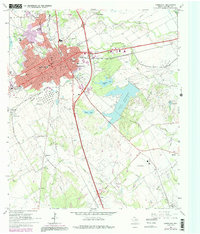
1965 Map of Corsicana
USGS Topo · Published 1992About this map
Corsicana is the industrial and educational hub of this mid-1960s landscape, anchored by Navarro College and a dense network of neighborhood schools like Lincoln Sch and Collins Jr High Sch. The region's deep ties to the petroleum industry are visible through the sprawling Corsicana Oil Field and the Powell Oil Field to the southeast, where numerous oil wells dot the terrain near Angus and Mildred. The municipal footprint includes substantial infrastructure such as the Corsicana Municipal Airport and multiple sewage disposal facilities, while the Rodeo Ground and Drive-in Theater point to the era's local recreation. Beyond the city center, rural life is marked by several historic family and community burial grounds, including the Hamilton Beeman Cem and Cosgrove Cem. The eastern landscape is dominated by Lake Halbert, which provides a significant water resource alongside Beaton Lake and the winding Post Oak Creek.
Find a feature on this map
60 named features on this map. Tap any name to fly to it.
Don’t see what you’re looking for? This feature index may not catch every label — zoom into the map to look around manually.
Map Details
Editions of this 1965 Corsicana Map
Other maps of this area

1954 · Dallas
USGS Topo · 1:250,000

1954 · Waco
USGS Topo · 1:250,000

1955 · Waco
USGS Topo · 1:250,000

1958 · Dallas
USGS Topo · 1:250,000

1959 · Powell
USGS Topo · 1:24,000

1960 · Streetman
USGS Topo · 1:24,000

1961 · Chatfield
USGS Topo · 1:24,000

1962 · Bazette
USGS Topo · 1:24,000

1962 · Emhouse
USGS Topo · 1:24,000

1963 · Richland
USGS Topo · 1:24,000