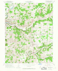
1966 Map of Corydon East
USGS Topo · Published 1977About this map
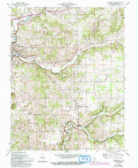
Louisville New Albany and Corydon RR tracks follow the winding course of Indian Creek and Little Indian Creek through this southern Indiana landscape. The terrain is defined by its karst topography, notable for Pfrimmer Cave and King Cave tucked into the hillsides. As of the mid-1960s, the area reflects a mix of traditional agriculture and emerging suburban pockets like Hillcrest. Local civic life centers on the Harrison Grange and the Corydon Country Club on the outskirts of the county seat.
Find a feature on this map
28 named features on this map. Tap any name to fly to it.
Don’t see what you’re looking for? This feature index may not catch every label — zoom into the map to look around manually.
Map Details
Editions of this 1966 Corydon East Map
5 editions found
Other maps of this area

1909 · Kosmosdale
USGS Topo · 1:48,000

1912 · Kosmosdale
USGS Topo · 1:62,500

1931 · Corydon
USGS Topo · 1:62,500

1939 · Georgetown
USGS Topo · 1:24,000

1944 · Corydon West
USGS Topo · 1:24,000

1946 · Depauw
USGS Topo · 1:24,000

1947 · Georgetown
USGS Topo · 1:24,000

1947 · Corydon West
USGS Topo · 1:24,000

1947 · Mauckport
USGS Topo · 1:24,000

1948 · Corydon East
USGS Topo · 1:24,000