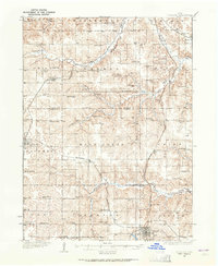
1934 Map of Corydon
USGS Topo · Published 1965About this map
Corydon stands as the primary hub in this mid-1930s depiction of southern Iowa, where the Chicago Rock Island and Pacific railroad intersects with State Highway No 3. The landscape is a dense network of township sections, each populated with the infrastructure of early 20th-century rural life. Numerous one-room schoolhouses, such as the curiously named Brown Jug Sch and Rabbit Ridge Sch, are spaced methodically across the terrain, serving the scattered farmsteads that define the region's economy.
Find a feature on this map
76 named features on this map. Tap any name to fly to it.
Don’t see what you’re looking for? This feature index may not catch every label — zoom into the map to look around manually.
Map Details
Editions of this 1934 Corydon Map
3 editions found
Other maps of this area

1918 · Chariton
USGS Topo · 1:62,500

1924 · Melcher
USGS Topo · 1:62,500

1934 · Humeston
USGS Topo · 1:48,000

1935 · Russell
USGS Topo · 1:62,500

1937 · Corydon
USGS Topo · 1:62,500

1938 · Russell
USGS Topo · 1:62,500

1942 · Seymour
USGS Topo · 1:62,500

1944 · Seymour
USGS Topo · 1:62,500

1950 · New Virginia
USGS Topo · 1:62,500

1952 · New Virginia
USGS Topo · 1:62,500