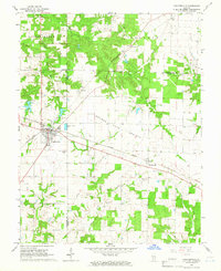
1965 Map of Coulterville
USGS Topo · Published 1966About this map
Coulterville serves as the primary hub of this mid-1960s landscape, situated at the junction of the Illinois Central and Missouri-Illinois railroads. The area reflects a transition between the open expanses of Grande Cote Prairie and the wooded drainages of South Mud Creek and Galum Creek. In this era, small rural communities like Swanwick and McKinley are connected by a network of rail lines and emerging infrastructure, including a prominent Radio Tower and municipal Waterworks facilities. Local history and genealogy are anchored by landmarks such as Bethel Cem and a city Park in the heart of Coulterville. The map also delineates the meeting point of Randolph, Washington, and Perry counties, showing how early agricultural boundaries and field lines shaped the region's development.
Find a feature on this map
25 named features on this map. Tap any name to fly to it.
Don’t see what you’re looking for? This feature index may not catch every label — zoom into the map to look around manually.
Map Details
Editions of this 1965 Coulterville Map
2 editions found
Other maps of this area

1910 · Okawville
USGS Topo · 1:62,500

1914 · Coulterville
USGS Topo · 1:62,500

1917 · Coulterville
USGS Topo · 1:62,500

1924 · Pinckneyville
USGS Topo · 1:62,500

1926 · Pinckneyville
USGS Topo · 1:62,500

1931 · Hoyleton
USGS Topo · 1:48,000

1932 · Nashville
USGS Topo · 1:62,500

1936 · Nashville
USGS Topo · 1:62,500

1940 · Okawville
USGS Topo · 1:62,500

1958 · Belleville
USGS Topo · 1:250,000