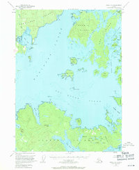
1951 Map of Craig D-5
USGS Topo · Published 1971About this map
Kosciusko Island and Heceta Island anchor this coastal survey, where the maritime topography of the Alexander Archipelago is mapped with precision from late 1940s aerial photography. The geography is defined by the deep waters of Davidson Inlet and Sea Otter Sound, surrounding a complex network of smaller landmasses like Marble Island and Orr Island. This region, within the Tongass National Forest, reveals a mid-century economy built on resource extraction and water-based logistics, evidenced by the Seaplane Base and Mine near Edna Bay.
Find a feature on this map
64 named features on this map. Tap any name to fly to it.
Don’t see what you’re looking for? This feature index may not catch every label — zoom into the map to look around manually.
Map Details
Editions of this 1951 Craig D-5 Map
5 editions found
Other maps of this area

1948 · Petersburg A-6
USGS Topo · 1:63,360

1949 · Craig D-4
USGS Topo · 1:63,360

1949 · Petersburg A-5
USGS Topo · 1:63,360

1949 · Petersburg A-4
USGS Topo · 1:63,360

1949 · Craig C-4
USGS Topo · 1:63,360

1951 · Craig C-6
USGS Topo · 1:63,360

1951 · Craig D-6
USGS Topo · 1:63,360

1951 · Craig C-4
USGS Topo · 1:63,360

1951 · Craig C-5
USGS Topo · 1:63,360

1951 · Craig D-5
USGS Topo · 1:63,360