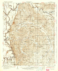
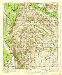
1935 Map of Crenshaw
USGS Topo · Published 1935About this map
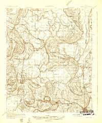
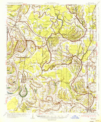
Crenshaw and the surrounding Yazoo-Mississippi Delta transition are documented here during the early 1930s, showing a landscape defined by the winding Coldwater River and its intricate drainage network. The area is heavily marked by a high density of rural infrastructure, particularly schools and churches that served scattered agricultural communities. Notable institutions include Ella Green Sch, Smith Chapel, and Evansville Ch, illustrating the social fabric of the era.
Find a feature on this map
65 named features on this map. Tap any name to fly to it.
Don’t see what you’re looking for? This feature index may not catch every label — zoom into the map to look around manually.
Map Details
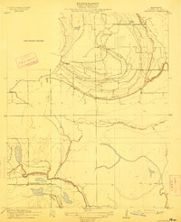
Editions of this 1935 Crenshaw Map
2 editions found
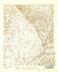
Other maps of this area

1908 · Hollywood
USGS Topo · 1:24,000

1908 · Walnut Lake
USGS Topo · 1:24,000

1910 · Walnut Lake
USGS Topo · 1:31,680
1913 · Hollywood
USGS Topo · 1:31,680

1931 · Horseshoe Lake
USGS Topo · 1:62,500

1932 · Horn Lake
USGS Topo · 1:48,000
1932 · Sledge
USGS Topo · 1:48,000
1932 · Marks
USGS Topo · 1:48,000

1932 · Crenshaw
USGS Topo · 1:62,500
1935 · Marks
USGS Topo · 1:62,500