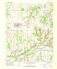
1970 Map of Crescent
USGS Topo · Published 1972About this map
Crescent serves as the primary hub of activity in this 1970 landscape, situated at a key intersection of regional transportation and industry. The town's social fabric is anchored by landmarks like St Margaret Mary Ch and Central Ch, while the surrounding Logan County countryside is defined by a dense concentration of petroleum extraction. The East Lovell Oil Field and Northeast Crescent Oil Field dominate the northern terrain, indicated by numerous individual oil well sites that speak to the era's energy production.
Find a feature on this map
36 named features on this map. Tap any name to fly to it.
Don’t see what you’re looking for? This feature index may not catch every label — zoom into the map to look around manually.
Map Details
Editions of this 1970 Crescent Map
2 editions found
Other maps of this area

1892 · Guthrie
USGS Topo · 1:62,500

1892 · Kingfisher
USGS Topo · 1:125,000

1893 · Mulhall
USGS Topo · 1:62,500

1893 · Lovell
USGS Topo · 1:62,500

1895 · Kingfisher
USGS Topo · 1:125,000

1954 · Oklahoma City
USGS Topo · 1:250,000

1955 · Enid
USGS Topo · 1:250,000

1957 · Oklahoma City
USGS Topo · 1:250,000

1958 · Enid
USGS Topo · 1:250,000

1963 · Oklahoma City
USGS Topo · 1:250,000