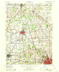
1943 Map of Crestline
USGS Topo · Published 1961About this map
The Pennsylvania Railroad and the Baltimore and Ohio Railroad converge at the industrial heart of Crestline and Shelby in this mid-century portrait of North Central Ohio. The landscape is defined by its intense rail connectivity, with the Northern Ohio Railway and the Cleveland Cincinnati Chicago and St Louis Railway lacing together established towns like Plymouth and Shiloh. Beyond the urban centers of Mansfield and Ontario, the terrain is a grid of agricultural townships such as Sharon and Jackson, dotted with an incredible density of numbered rural schoolhouses.
Find a feature on this map
62 named features on this map. Tap any name to fly to it.
Don’t see what you’re looking for? This feature index may not catch every label — zoom into the map to look around manually.
Map Details
Editions of this 1943 Crestline Map
2 editions found

Other maps of this area

1908 · Ashland
USGS Topo · 1:62,500

1908 · New London
USGS Topo · 1:62,500

1912 · Perrysville
USGS Topo · 1:62,500

1913 · Mount Gilead
USGS Topo · 1:62,500

1915 · Norwalk
USGS Topo · 1:62,500

1915 · Siam
USGS Topo · 1:62,500

1915 · Bucyrus
USGS Topo · 1:62,500

1915 · Crestline
USGS Topo · 1:62,500

1915 · Perrysville
USGS Topo · 1:62,500

1915 · Shauck
USGS Topo · 1:62,500