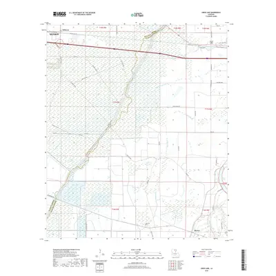
2018 Map of Crew Lake
USGS Topo · Published 2018About this map
Bayou Lafourche carves a winding path through this low-lying landscape along the border of Ouachita and Richland Parishes. The map illustrates a region dominated by intricate hydrography, from the expansive Crew Lake and Clear Lake in the east to more secluded waters like Water Lake and Bridge Brake. The settlement of Millhaven sits at the edge of the Monroe city limits, while the community of Rhymes is positioned near the southern bend of the Boeuf River.
Find a feature on this map
56 named features on this map. Tap any name to fly to it.
Don’t see what you’re looking for? This feature index may not catch every label — zoom into the map to look around manually.
Map Details
Editions of this 2018 Crew Lake Map
This is the sole edition of this map. No revisions or reprints were ever made.
Other maps of this area

1935 · Collinston
USGS Topo · 1:62,500

1935 · Alto
USGS Topo · 1:62,500

1935 · Drew
USGS Topo · 1:62,500

1940 · Monroe
USGS Topo · 1:62,500

1955 · Jackson
USGS Topo · 1:250,000

1955 · Shreveport
USGS Topo · 1:250,000

1956 · Shreveport
USGS Topo · 1:250,000

1957 · Monroe North
USGS Topo · 1:62,500

1957 · Mangham
USGS Topo · 1:62,500

1957 · Monroe South
USGS Topo · 1:24,000