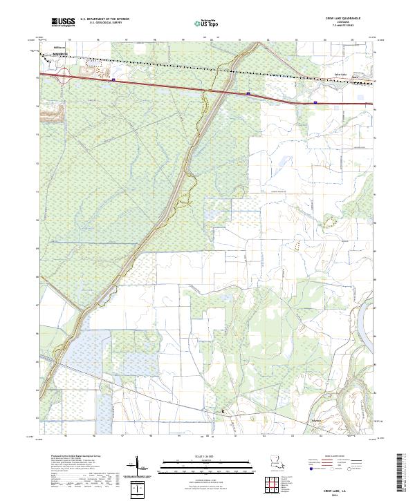
2024 Map of Crew Lake
USGS Topo · Published 2024About this map
Bayou Lafourche and the Boeuf River define the intricate drainage patterns of this northeast Louisiana landscape, where the boundary between Quachita Parish and Richland Parish follows the meandering course of the bayou. The settlement of Start occupies the northeastern reaches near the namesake Crew Lake, while Rhymes and Millhaven anchor the southern and northwestern corners. The terrain is marked by numerous water bodies and low-lying areas, including Bridge Brake, Water Lake, and Steep Bayou, reflecting the alluvial character of the Delta region.
Find a feature on this map
56 named features on this map. Tap any name to fly to it.
Don’t see what you’re looking for? This feature index may not catch every label — zoom into the map to look around manually.
Map Details
Editions of this 2024 Crew Lake Map
This is the sole edition of this map. No revisions or reprints were ever made.
Other maps of this area

1935 · Collinston
USGS Topo · 1:62,500

1935 · Alto
USGS Topo · 1:62,500

1935 · Drew
USGS Topo · 1:62,500

1940 · Monroe
USGS Topo · 1:62,500

1955 · Jackson
USGS Topo · 1:250,000

1955 · Shreveport
USGS Topo · 1:250,000

1956 · Shreveport
USGS Topo · 1:250,000

1957 · Monroe North
USGS Topo · 1:62,500

1957 · Mangham
USGS Topo · 1:62,500

1957 · Monroe South
USGS Topo · 1:24,000