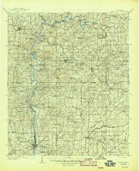
1906 Map of Dadeville
USGS Topo · Published 1945About this map
The Tallapoosa River snakes through the heart of this East Alabama landscape, serving as a vital corridor for commerce and transit at the turn of the twentieth century. Dozens of river crossings, including McCarty Ferry, Youngs Ferry, and Walker Ferry, illustrate a world where water transport and local ferries were essential before the widespread construction of modern bridges. The topography around Cherokee Bluffs reveals the natural drops in elevation that would later define the region's hydroelectric character.
Find a feature on this map
135 named features on this map. Tap any name to fly to it.
Don’t see what you’re looking for? This feature index may not catch every label — zoom into the map to look around manually.
Map Details
Editions of this 1906 Dadeville Map
3 editions found
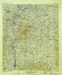
Other maps of this area

1890 · Talladega
USGS Topo · 1:125,000

1891 · Ashland
USGS Topo · 1:125,000

1892 · Talladega
USGS Topo · 1:125,000

1899 · Wedowee
USGS Topo · 1:125,000

1901 · Wetumpka
USGS Topo · 1:125,000

1901 · Wetumpka
USGS Topo · 1:62,500

1902 · Wedowee
USGS Topo · 1:125,000

1903 · Wetumpka
USGS Topo · 1:125,000

1906 · Dadeville
USGS Topo · 1:125,000

1907 · Opelika
USGS Topo · 1:125,000