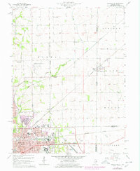
1966 Map of Danville NE
USGS Topo · Published 1978About this map
The industrial and transportation hub of Danville anchors this mid-century survey, revealing a landscape defined by an extensive web of railroads and regional infrastructure. Major rail lines including the Chicago and Eastern Illinois, Milwaukee St Paul and Pacific, and the New York Central converge here, facilitating the growth of the city's residential and educational districts. Significant institutional footprints are visible, from the VA Hospital and Danville Jr College to a dense concentration of local schools like East Park Jr High Sch and Northeast Sch.
Find a feature on this map
72 named features on this map. Tap any name to fly to it.
Don’t see what you’re looking for? This feature index may not catch every label — zoom into the map to look around manually.
Map Details
Editions of this 1966 Danville NE Map
2 editions found
Other maps of this area

1899 · Danville
USGS Topo · 1:62,500

1900 · Danville
USGS Topo · 1:62,500

1933 · Hoopeston
USGS Topo · 1:48,000

1938 · Hoopeston
USGS Topo · 1:62,500

1948 · Danville NW
USGS Topo · 1:24,000

1949 · Danville SW
USGS Topo · 1:24,000

1950 · Danville SW
USGS Topo · 1:24,000

1950 · Danville NW
USGS Topo · 1:24,000

1950 · Danville SE
USGS Topo · 1:24,000

1950 · Danville NE
USGS Topo · 1:24,000