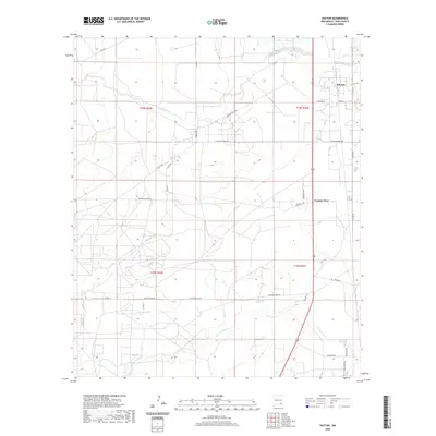
2020 Map of Dayton
USGS Topo · Published 2020About this map
Dayton sits near the crossing of the Rio Peñasco in this southern New Mexico landscape, where the Chihuahuan Desert terrain is defined by wide drainages and a network of rural access roads. The settlement of Frontier Post occupies a central position along the primary north-south corridor, serving as a landmark in a region dominated by ranching and resource extraction infrastructure. To the south, the watercourse of N Seven Rivers snakes across the plain, while the map reveals a complex system of ranch-named thoroughfares including Kincaid Ranch Rd and Rocking R Red Rd. These labels, alongside industrial features like Pipeline Rd, trace the intersection of traditional land use and modern utility in Eddy County. The presence of Skip Ranch Rd and Lakewood Rd further highlights the scattered residential and agricultural hubs that characterize this arid expanse.
Find a feature on this map
31 named features on this map. Tap any name to fly to it.
Don’t see what you’re looking for? This feature index may not catch every label — zoom into the map to look around manually.
Map Details
Editions of this 2020 Dayton Map
This is the sole edition of this map. No revisions or reprints were ever made.
Other maps of this area

1954 · Seven Rivers
USGS Topo · 1:24,000

1954 · Carlsbad
USGS Topo · 1:250,000

1955 · Artesia
USGS Topo · 1:24,000

1955 · Spring Lake
USGS Topo · 1:24,000

1955 · Dayton
USGS Topo · 1:24,000

1955 · Lake Mc Millan North
USGS Topo · 1:24,000

1955 · Lake Mc Millan South
USGS Topo · 1:24,000

1956 · Parish Ranch
USGS Topo · 1:24,000

1956 · Hope SE
USGS Topo · 1:24,000

1957 · Foster Ranch
USGS Topo · 1:24,000