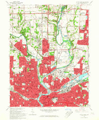
1965 Map of Dayton North
USGS Topo · Published 1967About this map
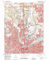
The confluence of the Great Miami River, Mad River, and Wolf Creek shapes the urban layout of Dayton in the mid-1960s. This survey records a period of significant suburban expansion, where the red-tinted built-up areas push north toward Murlin Heights and east into Huber Heights. The landscape is a mix of dense municipal infrastructure and large institutional grounds, including the United Theological Seminary, Sinclair College, and the Dayton Art Institute.
Find a feature on this map
80 named features on this map. Tap any name to fly to it.
Don’t see what you’re looking for? This feature index may not catch every label — zoom into the map to look around manually.
Map Details
Editions of this 1965 Dayton North Map
5 editions found
Other maps of this area

1904 · Dayton
USGS Topo · 1:62,500

1905 · Brookville
USGS Topo · 1:62,500

1906 · Dayton
USGS Topo · 1:62,500

1908 · Miamisburg
USGS Topo · 1:62,500

1913 · Waynesville
USGS Topo · 1:62,500

1915 · Waynesville
USGS Topo · 1:62,500

1953 · Cincinnati
USGS Topo · 1:250,000

1955 · Miamisburg
USGS Topo · 1:24,000

1955 · Dayton South
USGS Topo · 1:24,000
1955 · Bellbrook
USGS Topo · 1:24,000