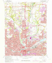
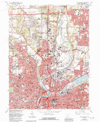
1965 Map of Dayton North
USGS Topo · Published 1976About this map
The confluence of the Great Miami River, Stillwater River, and Mad River anchors this 1960s-era study of northern Dayton. The landscape reflects a mid-century city in transition, where established neighborhoods like Fairview and Northridge meet expanding suburbs in Huber Heights and Murlin Heights. This period reveals a dense network of civic and religious institutions, including the United Theological Seminary and Good Samaritan Hospital, alongside many parochial schools like Our Lady of Mercy Ch.
Find a feature on this map
77 named features on this map. Tap any name to fly to it.
Don’t see what you’re looking for? This feature index may not catch every label — zoom into the map to look around manually.
Map Details
Editions of this 1965 Dayton North Map
5 editions found
Other maps of this area

1904 · Dayton
USGS Topo · 1:62,500

1905 · Brookville
USGS Topo · 1:62,500

1906 · Dayton
USGS Topo · 1:62,500

1908 · Miamisburg
USGS Topo · 1:62,500

1913 · Waynesville
USGS Topo · 1:62,500

1915 · Waynesville
USGS Topo · 1:62,500

1953 · Cincinnati
USGS Topo · 1:250,000

1955 · Miamisburg
USGS Topo · 1:24,000

1955 · Dayton South
USGS Topo · 1:24,000
1955 · Bellbrook
USGS Topo · 1:24,000