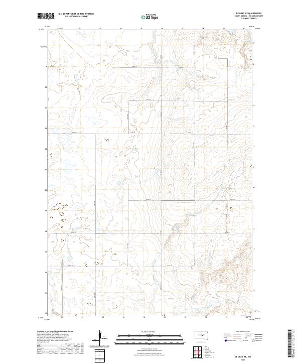
2021 Map of De Grey NE
USGS Topo · Published 2021About this map
Chapelle Cr meanders through the southeastern corner of this Hughes County landscape, defining the primary drainage for a region characterized by section-line roads and interior prairie depressions. The survey reveals a highly organized township structure across the junction of T111N and T112N, where the land is partitioned by a grid of local routes including 200th St and 320th Ave. Significant local thoroughfares like Co Rd 202 bisect the central townships, providing a clear view of the rural infrastructure in central South Dakota. This data provides researchers with a precise record of late-twentieth and early-twenty-first-century land divisions, showcasing the persistent reliance on the Public Land Survey System for property boundaries and access roads in the High Plains.
Find a feature on this map
18 named features on this map. Tap any name to fly to it.
Don’t see what you’re looking for? This feature index may not catch every label — zoom into the map to look around manually.
Map Details
Editions of this 2021 De Grey NE Map
This is the sole edition of this map. No revisions or reprints were ever made.
Other maps of this area

1953 · Huron
USGS Topo · 1:250,000

1954 · Huron
USGS Topo · 1:250,000

1967 · Blunt
USGS Topo · 1:24,000

1967 · Blunt SE
USGS Topo · 1:24,000

1967 · De Grey NE
USGS Topo · 1:24,000
1967 · De Grey NW
USGS Topo · 1:24,000

1968 · Harrold
USGS Topo · 1:24,000

1973 · De Grey SE
USGS Topo · 1:24,000
1973 · De Grey
USGS Topo · 1:24,000

1973 · Chapelle Lake SW
USGS Topo · 1:24,000