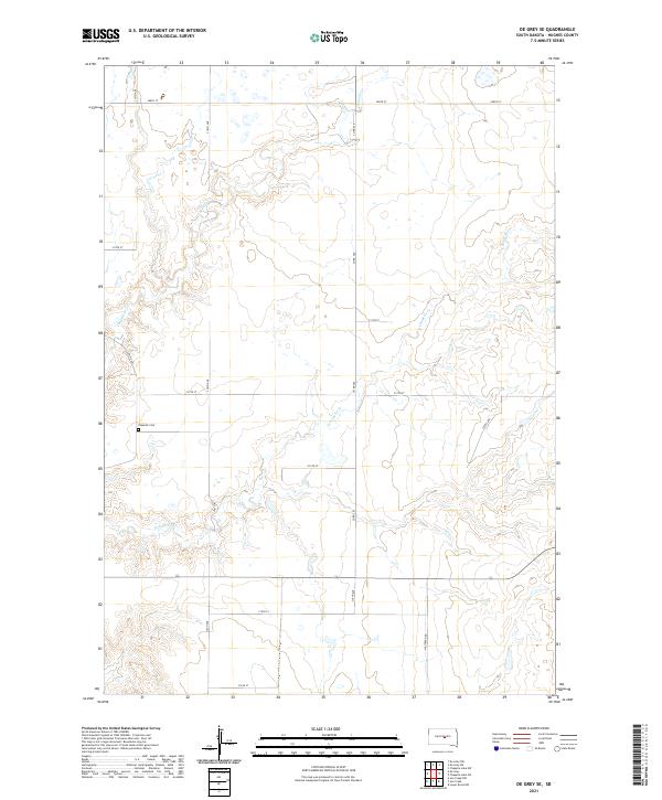
2021 Map of De Grey SE
USGS Topo · Published 2021About this map
Chapelle Cem sits in the western reaches of this Hughes County landscape, offering a focal point for genealogical research in this prairie region. The drainage patterns of Chapelle Cr and its southern branch, S Chapelle Cr, define the topography, carving paths through the township sections of T110N R75W and T109N R74W. This modern survey illustrates a rural infrastructure built upon a rigid grid of section-line roads, including Co Rd 202 and Westbend Rd. The map detail shows the persistent structure of South Dakota's land-run legacy, where family homesteads are linked by a network of numbered avenues and streets that navigate the subtle rises and creek beds of the high plains.
Find a feature on this map
23 named features on this map. Tap any name to fly to it.
Don’t see what you’re looking for? This feature index may not catch every label — zoom into the map to look around manually.
Map Details
Editions of this 2021 De Grey SE Map
This is the sole edition of this map. No revisions or reprints were ever made.
Other maps of this area

1953 · Huron
USGS Topo · 1:250,000

1954 · Huron
USGS Topo · 1:250,000

1966 · Lower Brule NW
USGS Topo · 1:24,000

1966 · Joe Creek
USGS Topo · 1:24,000

1966 · Joe Creek NW
USGS Topo · 1:24,000

1967 · De Grey NE
USGS Topo · 1:24,000
1967 · De Grey NW
USGS Topo · 1:24,000

1973 · De Grey SE
USGS Topo · 1:24,000
1973 · De Grey
USGS Topo · 1:24,000

1973 · Chapelle Lake SW
USGS Topo · 1:24,000