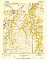
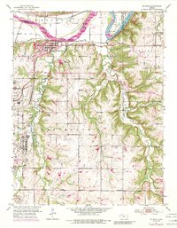
1951 Map of De Soto
USGS Topo · Published 1952About this map
The Sunflower Ordnance Works dominates the western edge of this Johnson County landscape, a massive industrial presence established during the Second World War. Adjoining it is the settlement of Sunflower, which sits near a complex network of infrastructure including a Filtration Plant and Sewage Disposal facilities. Along the northern border, the Kansas River flows past De Soto and Lenape, following the tracks of the Union Pacific and the Atchison Topeka and Santa Fe railroads.
Find a feature on this map
30 named features on this map. Tap any name to fly to it.
Don’t see what you’re looking for? This feature index may not catch every label — zoom into the map to look around manually.
Map Details
Editions of this 1951 De Soto Map
6 editions found

Other maps of this area

1885 · Lawrence
USGS Topo · 1:125,000

1886 · Oskaloosa
USGS Topo · 1:125,000

1887 · Olathe
USGS Topo · 1:125,000

1888 · Oskaloosa
USGS Topo · 1:125,000

1889 · Lawrence
USGS Topo · 1:125,000

1890 · Kansas City
USGS Topo · 1:125,000

1893 · Olathe
USGS Topo · 1:125,000

1894 · Kansas City
USGS Topo · 1:125,000

1894 · Oskaloosa
USGS Topo · 1:125,000

1934 · Bonner Springs
USGS Topo · 1:48,000