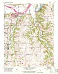
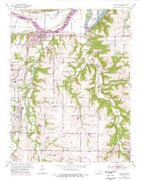
1951 Map of De Soto
USGS Topo · Published 1989About this map
The Kansas River flows along the northern edge of this landscape, separating Sherman and Delaware townships while defining the valley where De Soto and Lenape were established. The heavy industrial presence of the Sunflower Ordnance Works dominates the western portion of the map, complete with its own dedicated infrastructure like the Filtration Plant and Sewage Disposal systems. This facility reflects the mid-century transition of agricultural lands into strategic military-industrial sites.
Find a feature on this map
31 named features on this map. Tap any name to fly to it.
Don’t see what you’re looking for? This feature index may not catch every label — zoom into the map to look around manually.
Map Details
Editions of this 1951 De Soto Map
6 editions found

Other maps of this area

1885 · Lawrence
USGS Topo · 1:125,000

1886 · Oskaloosa
USGS Topo · 1:125,000

1887 · Olathe
USGS Topo · 1:125,000

1888 · Oskaloosa
USGS Topo · 1:125,000

1889 · Lawrence
USGS Topo · 1:125,000

1890 · Kansas City
USGS Topo · 1:125,000

1893 · Olathe
USGS Topo · 1:125,000

1894 · Kansas City
USGS Topo · 1:125,000

1894 · Oskaloosa
USGS Topo · 1:125,000

1934 · Bonner Springs
USGS Topo · 1:48,000