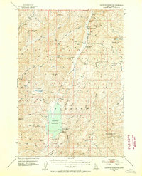
1953 Map of Deadwood Reservoir
USGS Topo · Published 1955About this map
Deadwood Reservoir anchors this high-elevation landscape in the Boise National Forest during the mid-1950s. The map illustrates a transitional period of resource management and early recreation, evidenced by the presence of the Deadwood Lodge and the Upper Deadwood Guard Station. Industrial history is etched into the terrain at the Deadwood Mine, the Mary Jane Mine, and the Mary Blue Mine, while fire detection infrastructure is represented by the Whitehawk Lookout atop Whitehawk Mountain. The complex drainage system of the Deadwood River and its numerous tributaries, such as Bernard Creek and Stratton Creek, defines the geography. Higher peaks like Pilgram Mtn and Bernard Mtn surround secluded basins such as Tranquil Basin and Ucon Basin, accessible only by the Landmark Stanley Road or a network of primitive trails and driveways.
Find a feature on this map
69 named features on this map. Tap any name to fly to it.
Don’t see what you’re looking for? This feature index may not catch every label — zoom into the map to look around manually.
Map Details
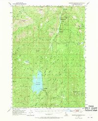
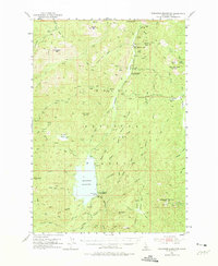
Editions of this 1953 Deadwood Reservoir Map
4 editions found
Other maps of this area

1891 · Bear Valley
USGS Topo · 1:125,000

1893 · Bear Valley
USGS Topo · 1:125,000

1909 · Garden Valley
USGS Topo · 1:125,000

1953 · Boiling Springs
USGS Topo · 1:62,500

1953 · Deadwood Reservoir
USGS Topo · 1:62,500

1954 · Gold Fork
USGS Topo · 1:62,500

1954 · Warm Lake
USGS Topo · 1:62,500

1957 · Challis
USGS Topo · 1:250,000

1959 · Garden Valley
USGS Topo · 1:62,500

1960 · Challis
USGS Topo · 1:250,000