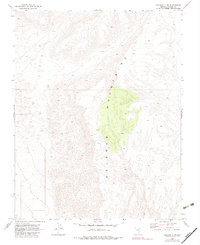
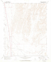
1969 Map of Delamar 3 NW
USGS Topo · Published 1983About this map
The Delamar Mountains dominate this high-desert landscape in Lincoln County, Nevada, as documented during the late 1960s. The topographic relief is defined by sharp ridgelines and desert washes, with elevations reaching over 6,100 feet. This quadrangle primarily captures the wilderness character of the region before any major cultural or drainage changes occurred, as verified by a 1980 photoinspection. The map includes the intersection of Range 62 East and Range 63 East and Township 8 South and Township 9 South, providing a foundational grid for land use and geological study in this uninhabited portion of the state.
Find a feature on this map
3 named features on this map. Tap any name to fly to it.
Don’t see what you’re looking for? This feature index may not catch every label — zoom into the map to look around manually.
Map Details
Editions of this 1969 Delamar 3 NW Map
3 editions found
Other maps of this area

1885 · Pioche
USGS Topo · 1:250,000

1886 · Pioche
USGS Topo · 1:250,000

1945 · Alamo
USGS Topo · 1:125,000

1954 · Caliente
USGS Topo · 1:250,000

1959 · Caliente
USGS Topo · 1:250,000

1969 · Alamo SE
USGS Topo · 1:24,000
1969 · Delamar 3 SE
USGS Topo · 1:24,000

1969 · Gregerson Basin
USGS Topo · 1:24,000

1969 · Delamar 3 NE
USGS Topo · 1:24,000
1969 · Delamar 3 SW
USGS Topo · 1:24,000