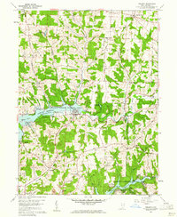
1959 Map of Dellroy
USGS Topo · Published 1961About this map
Dellroy sits at the heart of this Carroll County landscape, defined by the major water management projects of the Muskingum Watershed Conservancy District. The 1950s terrain is dominated by the sprawling reaches of the Atwood Reservoir to the west and the northern tip of Leesville Res to the south. Between these reservoirs, the map reveals a post-war rural economy transitioning from traditional farming to extraction, evidenced by numerous strip mines and oil wells dotting the ridges. The settlement pattern shows established villages like New Harrisburg and Sherrodsville connected by a network of winding valley roads, while the presence of an Old Railroad Grade and an airstrip near the reservoir speaks to shifting modes of transportation and the emerging recreational value of the local yacht clubs.
Find a feature on this map
61 named features on this map. Tap any name to fly to it.
Don’t see what you’re looking for? This feature index may not catch every label — zoom into the map to look around manually.
Map Details
Editions of this 1959 Dellroy Map
4 editions found
Other maps of this area

1902 · Scio
USGS Topo · 1:62,500

1904 · Scio
USGS Topo · 1:62,500

1909 · Uhrichsville
USGS Topo · 1:62,500

1910 · Carrollton
USGS Topo · 1:62,500

1911 · Uhrichsville
USGS Topo · 1:62,500

1912 · Dover
USGS Topo · 1:62,500

1912 · Carrollton
USGS Topo · 1:62,500

1944 · Dover
USGS Topo · 1:62,500

1951 · Canton
USGS Topo · 1:250,000

1953 · Canton
USGS Topo · 1:250,000