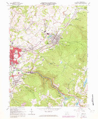
1964 Map of Derry
USGS Topo · Published 1973About this map
Loyalhanna Creek carves a deep valley through the center of this landscape, separating the rising slopes of Chestnut Ridge from the industrial corridors of the Penn Central railroad. The map documents an era of intense resource extraction and industrial activity in Westmoreland County, evidenced by numerous strip mines and a large Quarry near Longbridge. To the west, the growing footprint of Latrobe is visible, including its municipal Shopping Center and a Radio Tower (WQTW). Smaller coal-patch and company towns like Peanut, Superior, and New Derry are scattered across the terrain, many clustered around their local parish churches such as St Martins Ch or St Marys Ch. The transition toward recreation is also apparent at Keystone State Park and the Amusement Park near Darlington, reflecting the changing economy of the early 1970s.
Find a feature on this map
78 named features on this map. Tap any name to fly to it.
Don’t see what you’re looking for? This feature index may not catch every label — zoom into the map to look around manually.
Map Details
Editions of this 1964 Derry Map
4 editions found
Other maps of this area

1900 · Latrobe
USGS Topo · 1:62,500

1902 · Latrobe
USGS Topo · 1:62,500

1903 · Latrobe
USGS Topo · 1:62,500

1913 · Somerset
USGS Topo · 1:62,500

1915 · Somerset
USGS Topo · 1:62,500

1920 · New Florence
USGS Topo · 1:62,500

1921 · New Florence
USGS Topo · 1:48,000

1922 · Donegal
USGS Topo · 1:62,500

1922 · New Florence
USGS Topo · 1:62,500

1935 · Donegal
USGS Topo · 1:62,500