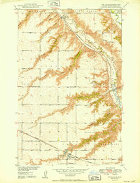
1950 Map of Des Lacs
USGS Topo · Published 1950About this map
Foxholm and Des Lacs serve as the primary hubs in this mid-century survey of Ward County, where the landscape is defined by the sharp incisions of coulees draining toward the Des Lacs River and Souris River. The area's development is anchored by the dual presence of the Great Northern and the Minneapolis St Paul and Sault Ste Marie railroads, which navigate the dramatic terrain of the river valleys. Local civic and social structures are clearly marked, including Town Hall and School No 3, alongside several named drainage features like Blacks Coulee, Glick Coulee, and Reihle Coulee. These labels often preserve the surnames of early families in the region. The map also identifies local landmarks of genealogical interest, such as St Marys Cem and Des Lacs Cem, providing a precise look at the township boundaries of Mayland, Saint Marys, and Foxholm.
Find a feature on this map
28 named features on this map. Tap any name to fly to it.
Don’t see what you’re looking for? This feature index may not catch every label — zoom into the map to look around manually.
Map Details
Editions of this 1950 Des Lacs Map
3 editions found
Other maps of this area

1928 · Minot
USGS Topo · 1:62,500

1948 · Burlington
USGS Topo · 1:24,000

1948 · Burlington
USGS Topo · 1:62,500

1948 · Minot NW
USGS Topo · 1:24,000

1949 · Burlington NW
USGS Topo · 1:24,000

1949 · Minot NW
USGS Topo · 1:24,000

1949 · Carpio NE
USGS Topo · 1:24,000

1949 · Carpio
USGS Topo · 1:24,000

1950 · Des Lacs
USGS Topo · 1:24,000
1950 · Burlington
USGS Topo · 1:24,000