
1954 Map of Dillingham B-4
USGS Topo · Published 1968About this map
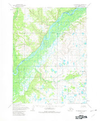
The Nushagak River dominates this mid-century landscape, carving a broad, braided path through a region defined by extensive marshlands and intricate drainage networks. Along its banks, the settlements of New Stuyahok and Ekwok serve as focal points for human activity, each accompanied by a landing strip that underscores the reliance on bush aviation for connectivity in this part of Alaska. The presence of Tunravik (Site) suggests an earlier habitation or seasonal camp near the confluence of Tunravik Creek and the main river channel.
Find a feature on this map
9 named features on this map. Tap any name to fly to it.
Don’t see what you’re looking for? This feature index may not catch every label — zoom into the map to look around manually.
Map Details
Editions of this 1954 Dillingham B-4 Map
2 editions found
Other maps of this area

1951 · Dillingham
USGS Topo · 1:250,000

1952 · Dillingham A-5
USGS Topo · 1:63,360

1952 · Dillingham A-4
USGS Topo · 1:63,360

1952 · Dillingham A-3
USGS Topo · 1:63,360

1954 · Dillingham
USGS Topo · 1:250,000

1954 · Dillingham C-3
USGS Topo · 1:63,360

1954 · Dillingham B-3
USGS Topo · 1:63,360
1954 · Dillingham B-5
USGS Topo · 1:63,360

1954 · Dillingham C-4
USGS Topo · 1:63,360

1954 · Dillingham C-5
USGS Topo · 1:63,360