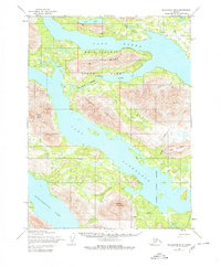
1954 Map of Dillingham B-8
USGS Topo · Published 1980About this map
Wood-Tikchik State Park dominates this southwestern Alaskan landscape, where the interconnected waters of Lake Nerka and Lake Aleknagik meet at the Agulowak River. The 1954 data, later updated with minor 1979 revisions, documents a wilderness of significant topographical relief, including Bumyok Ridge and the prominent Jackknife Mountain. These peaks overlook a network of glacial lakes and creeks such as Fenno Creek and Bear Creek.
Find a feature on this map
22 named features on this map. Tap any name to fly to it.
Don’t see what you’re looking for? This feature index may not catch every label — zoom into the map to look around manually.
Map Details
Editions of this 1954 Dillingham B-8 Map
2 editions found
Other maps of this area

1951 · Dillingham
USGS Topo · 1:250,000

1951 · Goodnews
USGS Topo · 1:250,000

1952 · Dillingham A-8
USGS Topo · 1:63,360

1952 · Dillingham A-7
USGS Topo · 1:63,360

1954 · Dillingham
USGS Topo · 1:250,000

1954 · Dillingham B-7
USGS Topo · 1:63,360

1954 · Dillingham B-8
USGS Topo · 1:63,360

1954 · Dillingham C-7
USGS Topo · 1:63,360

1954 · Dillingham C-8
USGS Topo · 1:63,360
1979 · Goodnews Bay A-1
USGS Topo · 1:63,360