2022 Map of Dorton
USGS Topo · Published 2022About this map
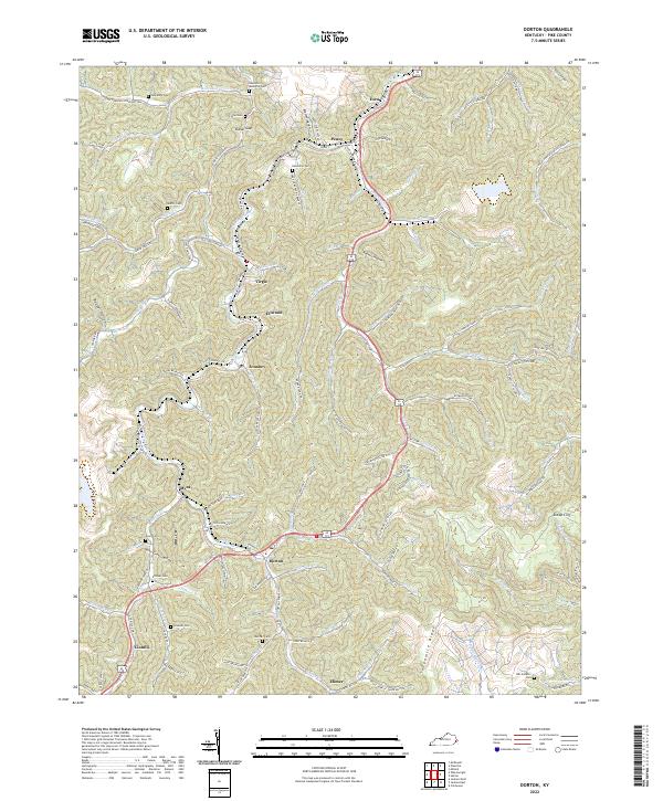
Shelby Creek and its many winding tributaries define the settlement patterns of this Pike County landscape, where communities like Dorton and Virgie follow the narrow valley floors. The map reveals a dense network of family-named landmarks and hollows, such as Bratten Hollow and Roberts Hollow, illustrating the deeply rooted genealogical history of the region. Local heritage is further preserved through numerous small burial grounds tucked into the hillsides, including the Newsome Memorial Cem, Stiltner Cem, and Sowards Cem.
Find a feature on this map
107 named features on this map. Tap any name to fly to it.
Don’t see what you’re looking for? This feature index may not catch every label — zoom into the map to look around manually.
Map Details
Editions of this 2022 Dorton Map
This is the sole edition of this map. No revisions or reprints were ever made.
Historical Maps of Myra Through Time
32 maps found

1914 Vergie
Pike County, KY

1915 Regina
Pike County, KY

1917 Regina
Pike County, KY

1954 Broad Bottom
Pike County, KY

1954 Dorton
Pike County, KY

1954 Hellier
Pike County, KY

1954 Jamboree
Pike County, KY

1954 Lick Creek
Pike County, KY

1954 Meta
Pike County, KY

1954 Millard
Pike County, KY

1954 Varney
Pike County, KY

1963 Jamboree
Pike County, KY

1978 Lick Creek
Pike County, KY

1978 Meta
Pike County, KY

1978 Millard
Pike County, KY

1979 Broad Bottom
Pike County, KY

1992 Broad Bottom
Pike County, KY

1992 Dorton
Pike County, KY

1992 Jenkins East
Pike County, KY

1992 Meta
Pike County, KY

1992 Varney
Pike County, KY

2001 Majestic
Pike County, KY

2022 Broad Bottom
Pike County, KY
2022 Dorton
Pike County, KY
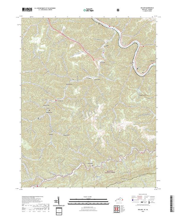
2022 Hellier
Pike County, KY

2022 Jamboree
Pike County, KY
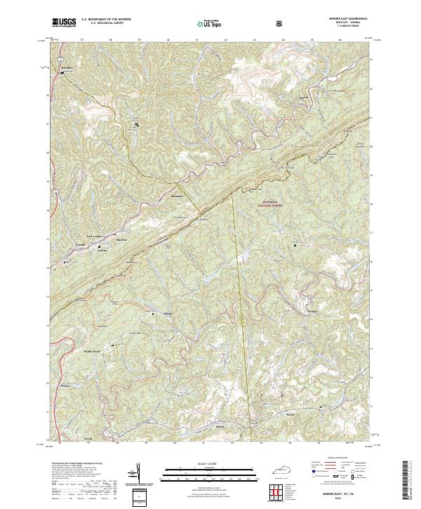
2022 Jenkins East
Pike County, KY

2022 Lick Creek
Pike County, KY

2022 Majestic
Pike County, KY

2022 Meta
Pike County, KY

2022 Millard
Pike County, KY

2022 Varney
Pike County, KY