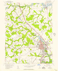
1956 Map of Dover
USGS Topo · Published 1957About this map
The state capital at Dover serves as the focal point of this 1950s survey, illustrating a period of mid-century growth along the Pennsylvania railroad line and the Dupont Highway. The map details the urban core, including the State Capitol, Courthouse, and educational institutions like State College and Wesley Jr College. Residential expansion is evident in emerging neighborhoods like Capitol Green and Rodney Village, while the surrounding countryside remains dotted with family-named landmarks such as Moores Corner and Casson Corner.
Find a feature on this map
69 named features on this map. Tap any name to fly to it.
Don’t see what you’re looking for? This feature index may not catch every label — zoom into the map to look around manually.
Map Details
Editions of this 1956 Dover Map
3 editions found
Other maps of this area

1890 · Bay Side
USGS Topo · 1:62,500

1894 · Bay Side
USGS Topo · 1:62,500

1899 · Vineland
USGS Topo · 1:125,000

1899 · Dover
USGS Topo · 1:125,000

1906 · Dover
USGS Topo · 1:125,000

1919 · Vineland
USGS Topo · 1:125,000

1920 · Dover
USGS Topo · 1:125,000

1926 · Wyoming
USGS Topo · 1:48,000

1930 · Wyoming
USGS Topo · 1:62,500

1931 · Wyoming
USGS Topo · 1:62,500