
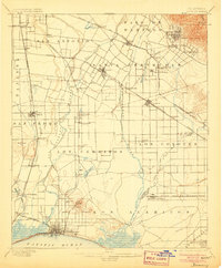
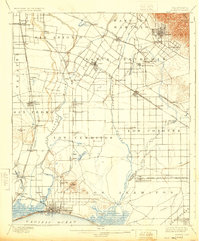
1902 Map of Downey
USGS Topo · Published 1902About this map
Large Spanish land grants still define the landscape of the Los Angeles basin in this 1890s-era survey, where boundaries for Santa Gertrudis, Los Cerritos, and Los Alamitos overlay a growing grid of citrus groves and early rail towns. The San Gabriel River and Rio Hondo dominate the hydrology of the plain, flowing toward Alamitos Bay and San Pedro Bay. The map captures a critical period of infrastructure development, showing the complex web of the Southern Pacific R.R. and Atchison Topeka and Santa Fe R.R. branches connecting established hubs like Whittier and Compton. Unique local markers include the Poor Farm Sta. and the artesian water sources indicated by Fulton Wells and the Bouton Well. Near the coast, early Long Beach is just beginning to expand inland from the Pacific shoreline.
Find a feature on this map
78 named features on this map. Tap any name to fly to it.
Don’t see what you’re looking for? This feature index may not catch every label — zoom into the map to look around manually.
Map Details
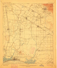
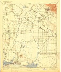
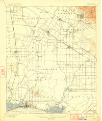
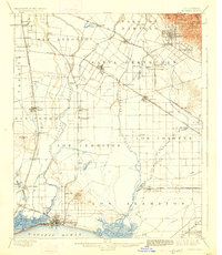
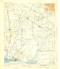
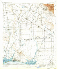
Editions of this 1902 Downey Map
9 editions found
Historical Maps of Willowville Through Time
5 maps found


