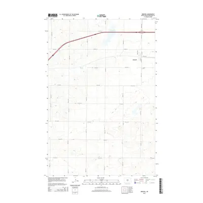
2014 Map of Driscoll
USGS Topo · Published 2014About this map
Driscoll serves as the primary hub for this agricultural portion of Burleigh County, situated along a busy transportation corridor defined by Interstate 94. The landscape is characterized by its post-glacial depression features, including the notable Cottonwood Lake to the north and the descriptively named Random Slough further west. These water bodies, surrounded by a systematic grid of section roads like 379th St NE and 30th Ave NE, indicate the persistent prairie pothole geography that shapes local farming and drainage patterns. Near the town center, the Driscoll Cem offers a genealogical focal point for families tied to the early settlement of the area. The road network, including Co Road 10 and S Main St, reflects a transition from traditional township roads to modern regional thoroughfares.
Find a feature on this map
31 named features on this map. Tap any name to fly to it.
Don’t see what you’re looking for? This feature index may not catch every label — zoom into the map to look around manually.
Map Details
Editions of this 2014 Driscoll Map
This is the sole edition of this map. No revisions or reprints were ever made.
Other maps of this area

1951 · McKenzie
USGS Topo · 1:62,500

1951 · Driscoll
USGS Topo · 1:62,500

1954 · Bismarck
USGS Topo · 1:250,000

1958 · Bismarck
USGS Topo · 1:250,000

1971 · Moffit
USGS Topo · 1:24,000

1975 · Sibley Butte
USGS Topo · 1:24,000

1975 · Sterling
USGS Topo · 1:24,000

1975 · Lake Geneva
USGS Topo · 1:24,000
1975 · Stony Slough
USGS Topo · 1:24,000
1975 · Clear Lake
USGS Topo · 1:24,000