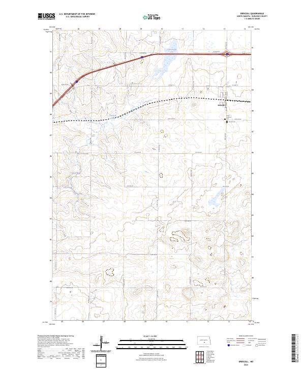
2024 Map of Driscoll
USGS Topo · Published 2024About this map
Driscoll serves as the primary settlement on this central North Dakota landscape, situated along the northern edge of the survey area. The local community structure is anchored by religious and memorial sites, including the Grace Lutheran Cem and Driscoll Cem. This region is defined by its numerous prairie potholes and wetlands, most notably Cottonwood Lake and Random Slough, which dot a terrain divided by an orderly grid of section lines and rural roads like 57th Ave NE and Co Hwy 10. The presence of these water bodies amongst the agricultural plots reflects the characteristic geography of Burleigh County, where natural drainage basins influence the layout of local transportation routes such as 17th Ave NE and Lincoln Rd.
Find a feature on this map
20 named features on this map. Tap any name to fly to it.
Don’t see what you’re looking for? This feature index may not catch every label — zoom into the map to look around manually.
Map Details
Editions of this 2024 Driscoll Map
This is the sole edition of this map. No revisions or reprints were ever made.
Other maps of this area

1951 · McKenzie
USGS Topo · 1:62,500

1951 · Driscoll
USGS Topo · 1:62,500

1954 · Bismarck
USGS Topo · 1:250,000

1958 · Bismarck
USGS Topo · 1:250,000

1971 · Moffit
USGS Topo · 1:24,000

1975 · Sibley Butte
USGS Topo · 1:24,000

1975 · Sterling
USGS Topo · 1:24,000

1975 · Lake Geneva
USGS Topo · 1:24,000
1975 · Stony Slough
USGS Topo · 1:24,000
1975 · Clear Lake
USGS Topo · 1:24,000