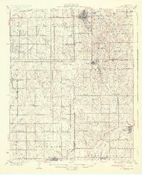
1931 Map of Drumright
USGS Topo · Published 1931About this map
The oil-rich landscape of Drumright and Shamrock dominates this 1931 survey, revealing the industrial footprint of the Cushing-Drumright Oil Field. Clusters of Oil Tanks and a dense network of country schools like Harmony Sch and Dry Hill Sch illustrate a period of intense rural settlement and resource extraction. The map preserves the transition from the Oklahoma Territory and Indian Territory era, with the former Indian Boundary cutting through the center of the sheet.
Find a feature on this map
55 named features on this map. Tap any name to fly to it.
Don’t see what you’re looking for? This feature index may not catch every label — zoom into the map to look around manually.
Map Details
Editions of this 1931 Drumright Map
4 editions found

Other maps of this area

1901 · Nuyaka
USGS Topo · 1:125,000

1905 · Chandler
USGS Topo · 1:62,500

1907 · Chandler
USGS Topo · 1:62,500

1908 · Agra
USGS Topo · 1:62,500

1912 · Hominy
USGS Topo · 1:125,000

1915 · Hominy
USGS Topo · 1:125,000

1916 · Bristow
USGS Topo · 1:62,500

1929 · Yale
USGS Topo · 1:62,500

1929 · Ripley
USGS Topo · 1:62,500

1929 · Stroud
USGS Topo · 1:62,500