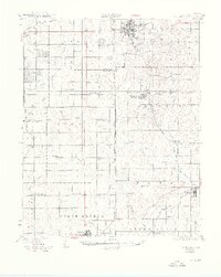
1931 Map of Drumright
USGS Topo · Published 1949About this map
Drumright and its surrounding oil fields define this early twentieth-century landscape, where industrial Oil Tanks sit alongside a dense network of country schools. The map preserves a moment when the region's economy was transitioning between the early petroleum boom and established agriculture, as seen in the numerous education centers like Happy Valley Sch and Antioch Sch that dot the countryside. A significant historical feature is the Indian Territory Oklahoma Boundary, which runs north-to-south through the center of the sheet, marking the older divisions of the land.
Find a feature on this map
61 named features on this map. Tap any name to fly to it.
Don’t see what you’re looking for? This feature index may not catch every label — zoom into the map to look around manually.
Map Details
Editions of this 1931 Drumright Map
4 editions found

Other maps of this area

1901 · Nuyaka
USGS Topo · 1:125,000

1905 · Chandler
USGS Topo · 1:62,500

1907 · Chandler
USGS Topo · 1:62,500

1908 · Agra
USGS Topo · 1:62,500

1912 · Hominy
USGS Topo · 1:125,000

1915 · Hominy
USGS Topo · 1:125,000

1916 · Bristow
USGS Topo · 1:62,500

1929 · Yale
USGS Topo · 1:62,500

1929 · Ripley
USGS Topo · 1:62,500

1929 · Stroud
USGS Topo · 1:62,500