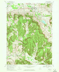
1969 Map of Dryden
USGS Topo · Published 1971About this map
The village of Dryden and its surrounding countryside are defined by the Lehigh Valley corridor, where the railroad and Virgil Creek cut through the high terrain of Tompkins County. To the south, the landscape is heavily forested, dominated by the expansive Yellow Barn State Forest and Hammond Hill State Forest. These protected lands are marked by prominent peaks such as Yellow Barn Hill and Star Stanton Hill, with small streams like Sixmile Creek carving narrow valleys through the hills.
Find a feature on this map
41 named features on this map. Tap any name to fly to it.
Don’t see what you’re looking for? This feature index may not catch every label — zoom into the map to look around manually.
Map Details
Editions of this 1969 Dryden Map
3 editions found
Other maps of this area

1898 · Moravia
USGS Topo · 1:62,500

1900 · Dryden
USGS Topo · 1:62,500

1902 · Moravia
USGS Topo · 1:62,500

1903 · Cortland
USGS Topo · 1:62,500

1903 · Harford
USGS Topo · 1:62,500

1906 · Catatonk
USGS Topo · 1:125,000

1942 · Groton
USGS Topo · 1:24,000

1943 · West Groton
USGS Topo · 1:31,680

1943 · Groton
USGS Topo · 1:31,680

1944 · Cortland
USGS Topo · 1:31,680