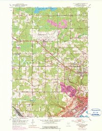
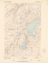
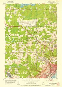
1953 Map of Duluth Heights
USGS Topo · Published 1990About this map
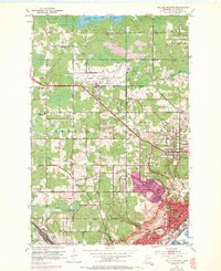
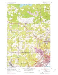
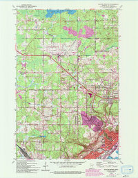
Duluth International Airport serves as a modern anchor in a landscape defined by its transition from the industrial heights of Duluth to the rural townships of Herman and Canosia. This mid-century view captures the expanding infrastructure above the lake bluffs, where the Iron Range and Missabe and Iron Range railroad lines converge at Missabe Junction. The distribution of cemeteries, such as Sunrise Memorial Cemetery and the Jewish Cem, alongside numerous small churches like Gethsemane Ch, suggests a community rooted in local heritage and family tradition. To the north, the Rice Lake Reservoir and Wild Rice Lake Reservoir dominate the upland drainage, while residential clusters like Duluth Heights and Proctor appear as distinct pockets of settlement within the wooded and marshy terrain.
Find a feature on this map
60 named features on this map. Tap any name to fly to it.
Don’t see what you’re looking for? This feature index may not catch every label — zoom into the map to look around manually.
Map Details
Editions of this 1953 Duluth Heights Map
5 editions found
Other maps of this area

1895 · Duluth
USGS Topo · 1:62,500

1915 · Superior
USGS Topo · 1:48,000

1917 · Superior
USGS Topo · 1:62,500
1953 · Twig
USGS Topo · 1:24,000
1953 · Adolph
USGS Topo · 1:24,000
1953 · Arnold
USGS Topo · 1:24,000
1953 · Duluth
USGS Topo · 1:24,000
1953 · Duluth Heights
USGS Topo · 1:24,000
1953 · Fredenberg
USGS Topo · 1:24,000

1953 · Duluth
USGS Topo · 1:62,500